Geography and Environment
P
|
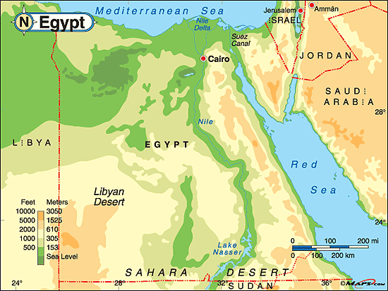
This map pictures the elevation levels of the country of Egypt. As you can see, the elevation of the land is very close to sea level near the Nile and increases as you move farther away from the river. The land elevations are varied throughout the country. Reference: Maps. (n.d.). Egypt physical map. Retrieved from http://www.maps.com/ref_map.aspx?pid=12011
|

This NASA map of Egypt depicts the amount of vegetation along with other geographical aspects of the country. Vegetation is mainly located in the Nile River valley while the rest of the country is built up of deserts. This shows why the Nile is imperative to the country and how much it really provides for the people. Reference: NASA Visible Earth. (2003). The lower Nile valley. Retrieved from http://visibleearth.nasa.gov/view.php?id=68269
|
|
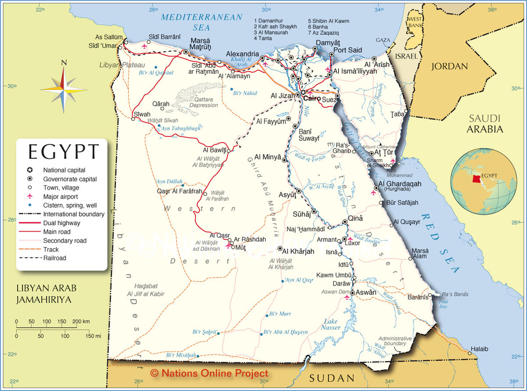
This is a modern political map showing capitals, towns, airports, borders, and roads and highways. It shows how the country is laid out in modern times and certain places and travel routes that allow the country to be functional. Reference: Nations Online Project. (n.d.). Political map of Egypt. Retrieved from http://www.nationsonline.org/oneworld/map/egypt_map.htm
|
Landscape Images
Human
Obviously, the pyramids are a huge human physical characteristic of the landscape of Egypt. They were built by hand with large amounts of stone for the rulers of the country. Reference: Penn State University. (2008, March 29). How Were The Egyptian Pyramids Built? ScienceDaily. Retrieved from www.sciencedaily.com/releases/2008/03/080328104302.htm
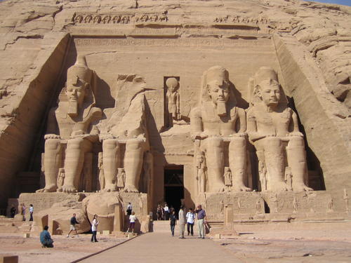
Another example of a human feature of Egypt. This is an image of one of the many temples built for the rulers of Egypt. Specifically, this image is of the temple built for Ramesses II. The four statues are of himself with the princes, princesses, and Queen Nefertari in between the legs. Reference: UNESCO. (n.d.). Nubian monuments from Abu Simbel to Philae. Retrieved from http://whc.unesco.org/en/list/88/
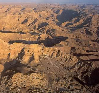
This image is of the Valley of the Kings, which is where the Egyptians buried their greatest rulers in temples (since building pyramids was a lot of work). Towards the bottom of the image is where the valley is located in the midst of a mountain range on the West Bank of the Nile River. This is a human feature because the "Valley of the Kings" was man made. The mountain ranges on the other hand are natural, physical features. Reference: Jimmy Dunn. (n.d.). The geography and geology
of the Valley of the Kings on the West Bank at Thebes. Tour Egypt. Retrieved from http://www.touregypt.net/featurestories/thebesgeology.htm
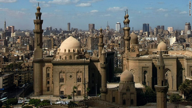
The city of Cairo, which is the capital of Egypt. This is a modern picture of the major city with the Mosque standing out in the center. Islam is a huge religion in modern Egyptian culture. Reference: Mark Tutton. (2011, Feb 11). Cairo: Finding the city behind the headlines. CNN. Retrieved from http://www.cnn.com/2011/WORLD/meast/02/11/cairo.life.city/
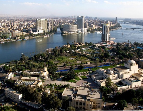
A picture that shows the layout and architecture of Cairo, Egypt in modern civilization. Reference: WCC. (2012, June 5). Cairo, Egypt. Paradise in the World. Retrieved from http://paradiseintheworld.com/cairo-egypt/
|
Physical
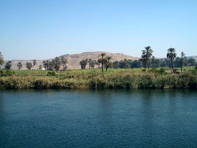
The Nile River is a major physical feature of the landscape of Egypt. It is the main source of water and provider for the necessary environment for their crops to thrive. Reference: Seven Natural Wonders. (n.d.). Nile river. Retrieved from http://sevennaturalwonders.org/africa/nile-river/
Papyrus was extremely important to the landscape since it was a huge source of "paper" for the Egyptians to communicate and express themselves in written format. It grew along the banks of the Nile River. Reference: All About Egypt. (n.d.). The gift of the Nile. Retrieved from http://all-about-egypt.com/the-gift-of-the-nile/
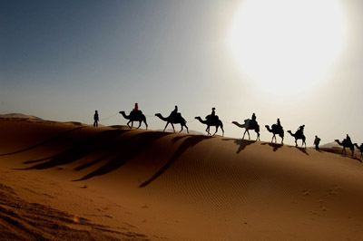
The Sahara Desert is a major physical landscape of Egypt. It covers a wide portion of the country and also depicts the kind of climate that the country has: dry and hot. Reference: Famous Wonders. (n.d.). Sahara Desert: Hottest desert in the world. Retrieved from http://famouswonders.com/sahara-desert-hottest-desert-in-the-world/

The quarries and mines of Egypt where limestone was gathered to produce and build the Egyptian pyramids and other structures of the ancient civilization. Reference: Jimmy Dunn. Mines and quarries of Ancient Egypt:
An introduction. Tour Egypt. Retrieved from http://www.touregypt.net/featurestories/minesandquarries1.htm
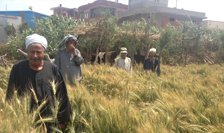
Wheat was a huge crop that contributed to the economy and success of Egypt in ancient times and still is today. The Nile River gives them the resource to grow wheat. Reference: Deya Abaza. (2013, April 16). Let them eat vegetables: Egypt's wheat farmers hit hard by diesel price hikes. Ahram Online. Retrieved from http://english.ahram.org.eg/News/69016.aspx
|
